|
Fisher
Slough Restoration Project
Fisher
Slough Final Design and Permitting
SUMMARY
The Nature Conservancy,
on behalf of several partners and landowners, has filed a shoreline
permit application and a special use permit application for a proposed
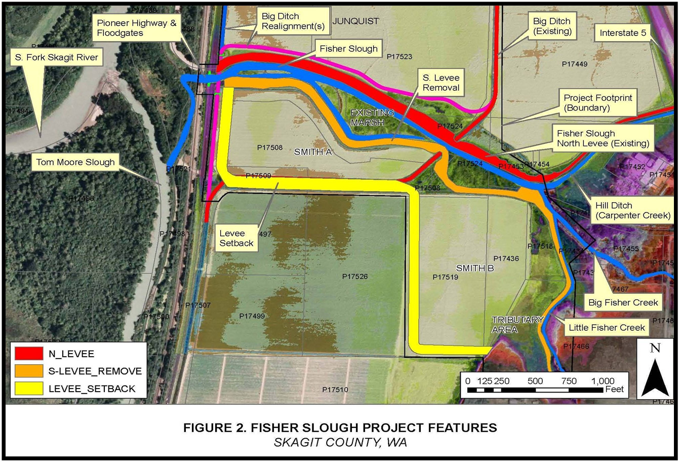
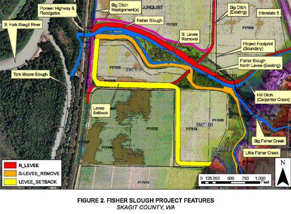
60 acre tidal marsh restoration project entitled Fisher Slough Restoration
Project.
The proposal is a collaborative effort of the Nature Conservancy,
Dike District 3, Drainage District 17 and local landowners to reconnect
natural freshwater tidal hydrology to approximately 50 acres of
currently diked floodplain, restore historical tidal marsh vegetation
communities, provide juvenile Chinook rearing habitat, remove fish
passage barriers and improve fish passage to several miles of tributary
spawning areas, increase watershed connectivity for coho, chum and
other native fish species, and improve flood and sediment storage
conditions for the tributary levee system.
The property is zoned Ag-NRL
and the shoreline designation is Rural.
Upon completion of the comment period and review of the application
materials, a public hearing will be held before the Skagit County
Hearing Examiner.
The applications and most of the background material is available
through the links below.
PROJECT LOCATION
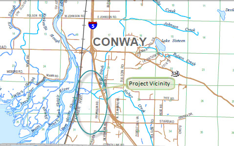
The proposal is located approximately 1.4 miles south of Conway
on the Pioneer Highway, adjacent to the Fisher Slough crossing.
Select image for lager view
|